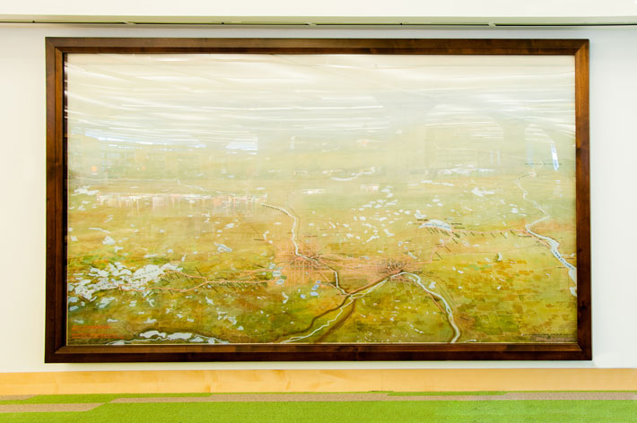
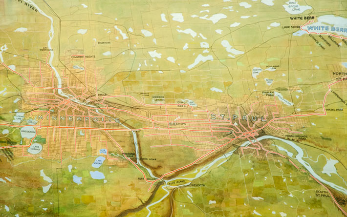
Perspective of St. Paul, Minneapolis and Vicinity
by
John Jager, 1904, 1916
Painting
About the art
Created in 1904 by architect John Jager and revised in 1916, this aerial perspective map was a technological marvel in its time. Executed in watercolor and gouache, the map measures 77 by 141 inches. The view depicts the transit lines through Minneapolis, St. Paul and the vicinity from 34 miles in the air; an achievement of pure artistic imagination, as this elevation was impossible for an artist at the time. The map was displayed at the 1904 St. Louis World’s Fair. It was drawn and exhibited by the Twin City Rapid Transit Company.
Photos